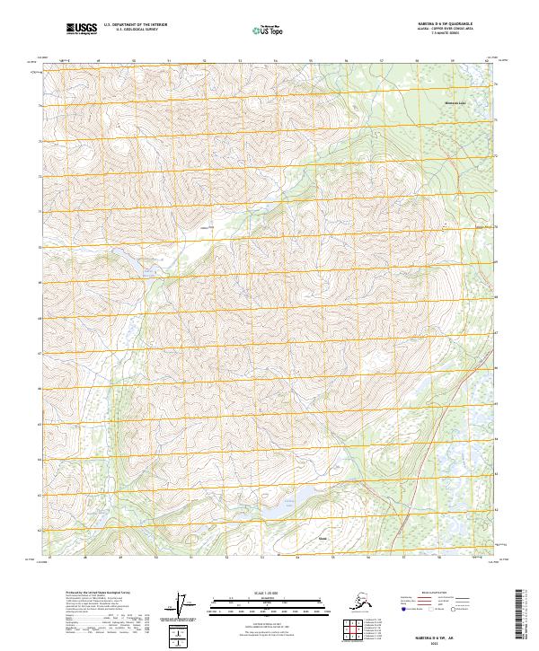
2023 Map of Nabesna D-6 SW
USGS Topo · Published 2023About this map
The Alaska Range serves as a towering backdrop for the high-altitude terrain where the Slana River headwaters begin their descent. Near the southern edge of the sheet, the small settlement of Slana marks a point of human connection in an otherwise wilderness-heavy landscape, while Mentasta Lake sits to the north. The area's geography is defined by narrow passes and glacial water bodies, including Indian Pass and the remote Indian Pass Lake.
Find a feature on this map
23 named features on this map. Tap any name to fly to it.
Don’t see what you’re looking for? This feature index may not catch every label — zoom into the map to look around manually.
Map Details
Editions of this 2023 Nabesna D-6 SW Map
This is the sole edition of this map. No revisions or reprints were ever made.
Other maps of this area

1948 · Nabesna C-6
USGS Topo · 1:63,360

1949 · Nabesna D-6
USGS Topo · 1:63,360

1949 · Gulkana C-1
USGS Topo · 1:63,360

1950 · Nabesna
USGS Topo · 1:250,000

1951 · Gulkana
USGS Topo · 1:250,000

1951 · Nabesna
USGS Topo · 1:250,000

1952 · Nabesna C-6
USGS Topo · 1:63,360

1952 · Nabesna D-6
USGS Topo · 1:63,360

1952 · Gulkana C-1
USGS Topo · 1:63,360
1954 · Gulkana D-1
USGS Topo · 1:63,360