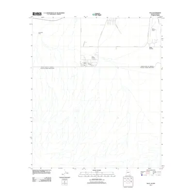
2011 Map of Naco
USGS Topo · Published 2011About this map
Naco sits directly on the international boundary between the United States and Mexico, serving as a focal point for trans-border transit and local services. The settlement layout is defined by its proximity to the border, with the Naco Post Office and local streets like W Newell St anchoring the community. Just north of the town, the Bisbee Municipal Golf Course and Bisbee Municipal Airport indicate the modern infrastructure supporting this high-desert region.
Find a feature on this map
16 named features on this map. Tap any name to fly to it.
Don’t see what you’re looking for? This feature index may not catch every label — zoom into the map to look around manually.
Map Details
Editions of this 2011 Naco Map
This is the sole edition of this map. No revisions or reprints were ever made.
Other maps of this area

1902 · Bisbee
USGS Topo · 1:62,500

1910 · Bisbee
USGS Topo · 1:62,500

1914 · Hereford
USGS Topo · 1:125,000

1916 · Douglas
USGS Topo · 1:125,000

1919 · Douglas
USGS Topo · 1:125,000

1927 · Bisbee
USGS Topo · 1:62,500

1932 · Stark
USGS Topo · 1:62,500
1933 · Bisbee
USGS Topo · 1:62,500
1952 · Hereford
USGS Topo · 1:24,000
1952 · Stark
USGS Topo · 1:24,000