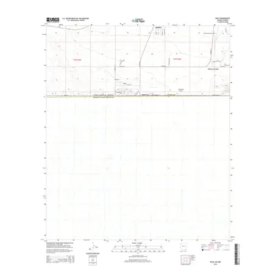
2014 Map of Naco
USGS Topo · Published 2014About this map
Naco stands at the international boundary between the United States of America and Estados Unidos Mexicanos during the mid-2010s. This borderland landscape in Cochise County is defined by the grid of small-town streets like W Newell St and W Martinez St that meet the jagged line of Border Rd. To the northeast, the settlement of Bisbee Junction and the Bisbee Municipal Airport serve as landmarks in the high desert, where the natural drainage of Greenbush Draw cuts across the arid terrain. The map details a transition from the structured residential blocks of Naco to the expansive rural sections of Township 24 South, Range 24 East. Transportation is anchored by S Naco Hwy and Az-92, which connect this frontier community to the southern outskirts of Bisbee.
Find a feature on this map
34 named features on this map. Tap any name to fly to it.
Don’t see what you’re looking for? This feature index may not catch every label — zoom into the map to look around manually.
Map Details
Editions of this 2014 Naco Map
This is the sole edition of this map. No revisions or reprints were ever made.
Other maps of this area

1902 · Bisbee
USGS Topo · 1:62,500

1910 · Bisbee
USGS Topo · 1:62,500

1914 · Hereford
USGS Topo · 1:125,000

1916 · Douglas
USGS Topo · 1:125,000

1919 · Douglas
USGS Topo · 1:125,000

1927 · Bisbee
USGS Topo · 1:62,500

1932 · Stark
USGS Topo · 1:62,500
1933 · Bisbee
USGS Topo · 1:62,500
1952 · Hereford
USGS Topo · 1:24,000
1952 · Stark
USGS Topo · 1:24,000