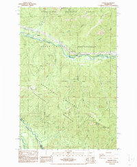
1986 Map of Nagrom
USGS Topo · Published 1986About this map
Nagrom sits as a notable location along the Green River in this mid-1980s provisional study, a point where historical industry met the protected wilderness of the Snoqualmie National Forest. The landscape is dominated by the steep ascent of Huckleberry Mountain and the deep cut of Green River Canyon, illustrating the challenging terrain that shaped early transportation and resource extraction in the region.
Find a feature on this map
27 named features on this map. Tap any name to fly to it.
Don’t see what you’re looking for? This feature index may not catch every label — zoom into the map to look around manually.
Map Details
Editions of this 1986 Nagrom Map
This is the sole edition of this map. No revisions or reprints were ever made.
Other maps of this area

1901 · Snoqualmie Pass
USGS Topo · 1:125,000

1903 · Snoqualmie
USGS Topo · 1:125,000

1913 · Cedar Lake
USGS Topo · 1:125,000

1956 · Greenwater
USGS Topo · 1:62,500

1957 · Wenatchee
USGS Topo · 1:250,000

1960 · Bandera
USGS Topo · 1:62,500

1961 · Snoqualmie Pass
USGS Topo · 1:62,500

1962 · Lester
USGS Topo · 1:62,500

1975 · Snoqualmie Pass
USGS Topo · 1:100,000
1986 · Clear West Peak
USGS Topo · 1:24,000