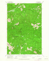
1962 Map of Lester
USGS Topo · Published 1964About this map
The Lester settlement and the Northern Pacific railroad corridor define the northwestern corner of this 1962 topographical study. This territory is a complex junction of the Snoqualmie National Forest and Wenatchee National Forest, where the protected Green River Watershed (City of Tacoma) dominates the upper river valley. The map reveals a landscape defined by significant high-altitude passes and meadows, including Naches Pass and Government Meadow, which have served as vital crossing points through the Cascade Range. South of the Green River, the terrain rises sharply toward peaks like Arch Rock and Castle Mtn, while the Green River Airstrip provides a rare point of modern infrastructure in the deep forest. The density of named creeks and ridges, such as Sawmill Ridge and Pyramid Creek, illustrates the intricate drainage system feeding the Greenwater River and the Little Naches River.
Find a feature on this map
66 named features on this map. Tap any name to fly to it.
Don’t see what you’re looking for? This feature index may not catch every label — zoom into the map to look around manually.
Map Details
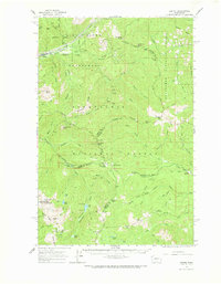
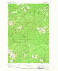
Editions of this 1962 Lester Map
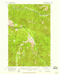
Other maps of this area

1901 · Snoqualmie Pass
USGS Topo · 1:125,000

1902 · Mount Aix
USGS Topo · 1:125,000

1903 · Snoqualmie
USGS Topo · 1:125,000

1904 · Mt Aix
USGS Topo · 1:125,000

1913 · Cedar Lake
USGS Topo · 1:125,000

1924 · Mt Rainier
USGS Topo · 1:96,000

1928 · Mt Rainier
USGS Topo · 1:125,000

1950 · Yakima
USGS Topo · 1:250,000
1956 · Greenwater
USGS Topo · 1:62,500

1957 · Wenatchee
USGS Topo · 1:250,000