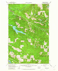
1960 Map of Bandera
USGS Topo · Published 1962About this map
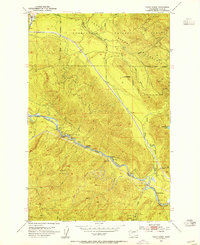
The Chicago Milwaukee St Paul and Pacific railroad carves a critical path through the high passes and river valleys of the Cascade Range in this 1960s study. The landscape is defined by the massive Snoqualmie Watershed and Green River Watershed, protected lands that supply the growing Puget Sound cities. Recreation and industry coexist in the heights, from the educational grounds of Camp Waskowitz to the Horseshoe Mine and scattered gravel operations like the Ragnar Pit. High-altitude lakes including Lake Kulla Kulla and Pratt Lake dot the mountain flanks under peaks like McClellan Butte and Mt Defiance. The presence of small outposts like Camp Joy and the City Cabin suggests the area's ongoing importance for forest management and watershed protection during a period of expanding infrastructure.
Find a feature on this map
101 named features on this map. Tap any name to fly to it.
Don’t see what you’re looking for? This feature index may not catch every label — zoom into the map to look around manually.
Map Details
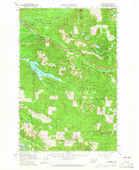
Editions of this 1960 Bandera Map
3 editions found

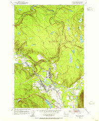
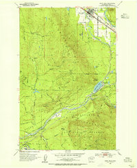
Other maps of this area

1901 · Snoqualmie Pass
USGS Topo · 1:125,000

1902 · Skykomish
USGS Topo · 1:125,000

1903 · Snoqualmie
USGS Topo · 1:125,000

1905 · Skykomish
USGS Topo · 1:125,000

1913 · Cedar Lake
USGS Topo · 1:125,000

1921 · Sultan
USGS Topo · 1:125,000

1923 · Sultan
USGS Topo · 1:125,000
1953 · Snoqualmie
USGS Topo · 1:24,000
1953 · North Bend
USGS Topo · 1:24,000
1953 · Eagle Gorge
USGS Topo · 1:24,000