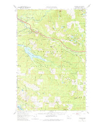
1960 Map of Bandera
USGS Topo · Published 1975About this map
The Snoqualmie National Forest dominates this landscape, showing a mountain terrain heavily defined by early water management and timber-line rail operations. Large swaths of the territory are divided into specialized management zones, most notably the Cedar River Watershed surrounding Chester Morse Lake and the Green River Watershed to the south. These protected areas reveal a carefully regulated wildland intended to secure municipal water supplies for growing Puget Sound cities.
Find a feature on this map
115 named features on this map. Tap any name to fly to it.
Don’t see what you’re looking for? This feature index may not catch every label — zoom into the map to look around manually.
Map Details
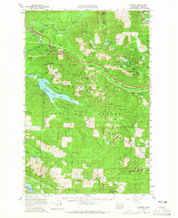
Editions of this 1960 Bandera Map
3 editions found

Other maps of this area

1901 · Snoqualmie Pass
USGS Topo · 1:125,000

1902 · Skykomish
USGS Topo · 1:125,000

1903 · Snoqualmie
USGS Topo · 1:125,000

1905 · Skykomish
USGS Topo · 1:125,000

1913 · Cedar Lake
USGS Topo · 1:125,000

1921 · Sultan
USGS Topo · 1:125,000

1923 · Sultan
USGS Topo · 1:125,000

1953 · Snoqualmie
USGS Topo · 1:24,000

1953 · North Bend
USGS Topo · 1:24,000

1953 · Eagle Gorge
USGS Topo · 1:24,000