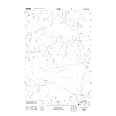
2012 Map of Nahant
USGS Topo · Published 2012About this map
Dumont and the settlement at Nahant anchor this survey of the high mountain drainages in Lawrence County. The landscape is defined by an intricate network of ranching and forestry roads, including the Dumont Branch 2B and Rochford Road, which follow the winding path of N Fork Rapid Cr. Family ranching legacies are visible throughout the terrain, from Juso Ranch in the north to the Sasse Ranch and Hausle Ranch in the south, suggesting a long-standing pattern of high-country land use.
Find a feature on this map
70 named features on this map. Tap any name to fly to it.
Don’t see what you’re looking for? This feature index may not catch every label — zoom into the map to look around manually.
Map Details
Editions of this 2012 Nahant Map
This is the sole edition of this map. No revisions or reprints were ever made.
Other maps of this area

1894 · Deadwood
USGS Topo · 1:125,000

1899 · Sturgis
USGS Topo · 1:62,500

1900 · Spearfish
USGS Topo · 1:62,500

1901 · Deadwood
USGS Topo · 1:125,000

1915 · Spearfish
USGS Topo · 1:62,500

1915 · Sturgis
USGS Topo · 1:62,500

1916 · Deadwood
USGS Topo · 1:125,000

1953 · Rapid City
USGS Topo · 1:250,000
1956 · Crooks Tower
USGS Topo · 1:24,000
1956 · Crows Nest Peak
USGS Topo · 1:24,000