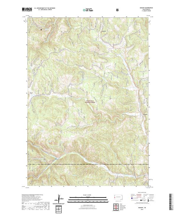
2021 Map of Nahant
USGS Topo · Published 2021About this map
Black Hills National Forest land defines the character of this mountain region, where the historical settlements of Nahant and Dumont sit along a complex network of forest roads and trails. The terrain is deeply incised by numerous drainages, including Wildcat Gulch, Billings Draw, and Cave Draw, reflecting a landscape where water and topography dictated movement. Genealogists may find particular value in the Carr Cem located in the northwest, near the headwaters of Ward Spring. The map documents a modern snapshot of the area's forest management history, showing the intricate system of access roads like the Besant Park Br 2j and various snow trails that serve the recreational and utilitarian needs of the Lawrence and Pennington county borderlands. These paths connect springs such as Black Fox Spring and Beaver Spring with remote park areas like Besant Park.
Find a feature on this map
88 named features on this map. Tap any name to fly to it.
Don’t see what you’re looking for? This feature index may not catch every label — zoom into the map to look around manually.
Map Details
Editions of this 2021 Nahant Map
This is the sole edition of this map. No revisions or reprints were ever made.
Other maps of this area

1894 · Deadwood
USGS Topo · 1:125,000

1899 · Sturgis
USGS Topo · 1:62,500

1900 · Spearfish
USGS Topo · 1:62,500

1901 · Deadwood
USGS Topo · 1:125,000

1915 · Spearfish
USGS Topo · 1:62,500

1915 · Sturgis
USGS Topo · 1:62,500

1916 · Deadwood
USGS Topo · 1:125,000

1953 · Rapid City
USGS Topo · 1:250,000
1956 · Crooks Tower
USGS Topo · 1:24,000
1956 · Crows Nest Peak
USGS Topo · 1:24,000