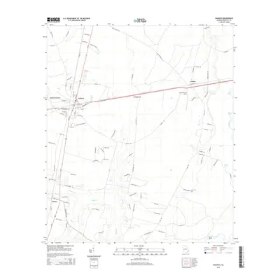
2014 Map of Nahunta
USGS Topo · Published 2014About this map
Nahunta serves as the central hub of this Brantley County landscape, where the intersection of regional thoroughfares and local streets like Satilla Ave and Cleveland St E define the town's structure. The surrounding area is characterized by a network of waterways and low-lying drainages, including the winding course of Buffalo Creek and Little Buffalo Creek. To the east, the Satilla River forms a significant natural boundary, accompanied by features such as Dead River and Buck Lake. Small settlements and named locales like Lulaton, Prosperity, and Hickox are connected by rural routes such as Seed Orchard Rd and Co Road 92. This 2014 survey documents the modern infrastructure of the region, including the Brantley County Airport and the quiet presence of Knox Cemetery, reflecting the enduring settlement patterns in this part of Georgia.
Find a feature on this map
97 named features on this map. Tap any name to fly to it.
Don’t see what you’re looking for? This feature index may not catch every label — zoom into the map to look around manually.
Map Details
Editions of this 2014 Nahunta Map
This is the sole edition of this map. No revisions or reprints were ever made.
Other maps of this area

1917 · Nahunta
USGS Topo · 1:62,500

1918 · Hortense
USGS Topo · 1:62,500

1918 · Nahunta
USGS Topo · 1:62,500

1944 · Hortense
USGS Topo · 1:62,500

1946 · Brunswick
USGS Topo · 1:250,000

1948 · Brunswick
USGS Topo · 1:250,000

1953 · Waycross
USGS Topo · 1:250,000

1956 · Brunswick
USGS Topo · 1:250,000

1958 · Waycross
USGS Topo · 1:250,000

1961 · Brunswick
USGS Topo · 1:250,000