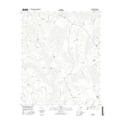
2016 Map of Nakina
USGS Topo · Published 2016About this map
Low-lying Carolina bays and intricate wetlands define this portion of Columbus County, where settlements like Antioch and Needmore sit among a vast network of watercourses and swamps. The landscape is dominated by the sprawling Beaver Dam Swamp and Gum Swamp, with numerous named bridges such as Nellie Ford Bridge and Stanley Ford Bridge facilitating travel across the many branches and creeks.
Find a feature on this map
95 named features on this map. Tap any name to fly to it.
Don’t see what you’re looking for? This feature index may not catch every label — zoom into the map to look around manually.
Map Details
Editions of this 2016 Nakina Map
This is the sole edition of this map. No revisions or reprints were ever made.
Other maps of this area

1943 · Pireway
USGS Topo · 1:31,680

1943 · Nakina
USGS Topo · 1:24,000

1943 · Freeland
USGS Topo · 1:24,000
1953 · Pireway
USGS Topo · 1:24,000

1953 · Chadbourn
USGS Topo · 1:62,500

1953 · Florence
USGS Topo · 1:250,000

1954 · Florence
USGS Topo · 1:250,000

1955 · Whiteville
USGS Topo · 1:62,500
1962 · Goretown
USGS Topo · 1:24,000
1962 · Tabor City East
USGS Topo · 1:24,000