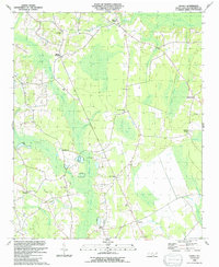
1990 Map of Nakina
USGS Topo · Published 1991About this map
Big Bay and Camp Bay dominate this coastal plain landscape, where dense swamp forests and pocosin wetlands dictate the pattern of human settlement. The rural communities of Antioch, Whites Crossing, and Nakina are interconnected by a network of roads that carefully skirt the edges of saturated terrain like Beaver Dam Swamp and Mollie Swamp. The map reveals a deeply rooted social fabric through its numerous country churches and family burial grounds, including Faith Ch, Sweet Home Ch, and the McKeithan Cem.
Find a feature on this map
41 named features on this map. Tap any name to fly to it.
Don’t see what you’re looking for? This feature index may not catch every label — zoom into the map to look around manually.
Map Details
Editions of this 1990 Nakina Map
This is the sole edition of this map. No revisions or reprints were ever made.
Other maps of this area

1943 · Pireway
USGS Topo · 1:31,680

1943 · Nakina
USGS Topo · 1:24,000

1943 · Freeland
USGS Topo · 1:24,000
1953 · Pireway
USGS Topo · 1:24,000

1953 · Chadbourn
USGS Topo · 1:62,500

1953 · Florence
USGS Topo · 1:250,000

1954 · Florence
USGS Topo · 1:250,000

1955 · Whiteville
USGS Topo · 1:62,500
1962 · Goretown
USGS Topo · 1:24,000
1962 · Tabor City East
USGS Topo · 1:24,000