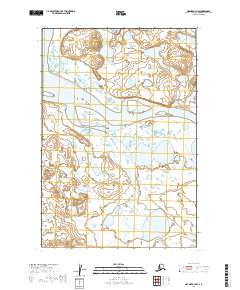
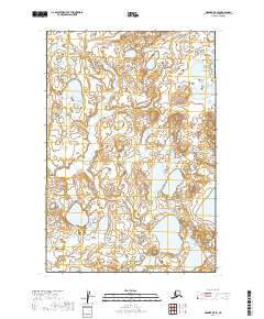
2019 Map of Naknek A-4 NW
USGS Topo · Published 2019About this map
Egegik sits at the northern edge of the Egegik River, serving as a focal point for this wetland-heavy landscape near the coast. The river system dominates the terrain, with the wide main channel of the Egegik River flowing westward past Egg Island. Further north, the King Salmon River enters the frame, while the southern reaches are defined by the winding course of the Swampy River. This 2019 survey illustrates the dense network of small lakes and marshes characteristic of the Bristol Bay region. The presence of Chifies Road provides a rare point of overland access in an area where the water remains the primary thoroughfare for commerce and transport. Smaller bodies of water like Summit Lake are scattered throughout the low-lying interior, highlighting the complex drainage patterns of the coastal tundra.
Find a feature on this map
13 named features on this map. Tap any name to fly to it.
Don’t see what you’re looking for? This feature index may not catch every label — zoom into the map to look around manually.
Map Details
Editions of this 2019 Naknek A-4 NW Map
This is the sole edition of this map. No revisions or reprints were ever made.
Other maps of this area

1951 · Naknek A-5
USGS Topo · 1:63,360

1951 · Naknek A-4
USGS Topo · 1:63,360

1952 · Naknek
USGS Topo · 1:250,000

1952 · Naknek B-4
USGS Topo · 1:63,360

1952 · Naknek B-5
USGS Topo · 1:63,360

1964 · Naknek
USGS Topo · 1:250,000
2019 · Naknek B-4 SW
USGS Topo · 1:25,000
2019 · Naknek B-4 SE
USGS Topo · 1:25,000
2019 · Naknek A-4 SE
USGS Topo · 1:25,000
2019 · Naknek B-5 SE
USGS Topo · 1:25,000