
1951 Map of Naknek A-4
USGS Topo · Published 1956About this map
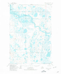
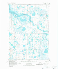
The Egegik River and King Salmon River dominate this 1951 landscape, where the tides of the Bristol Bay region meet a complex network of wetlands and tundra. This survey, compiled from aerial photography, illustrates the hydrographic transition from the main river channels to the expansive Tidal Flat surrounding Egg Island and King Salmon Island. The interior is characterized by the meandering path of the Swampy River and numerous unnamed lakes and ponds typical of the Alaska Peninsula. Evidence of human presence is minimal, marked only by a solitary Cabin in the southeastern quadrant, highlighting the isolation of this region during the early 1950s. Surveyors established several control points across the terrain, including VABM 132 Sal and VABM 276 Ege, which provided the necessary triangulation for mapping this often-inaccessible shoreline and river system.
Find a feature on this map
11 named features on this map. Tap any name to fly to it.
Don’t see what you’re looking for? This feature index may not catch every label — zoom into the map to look around manually.
Map Details
Editions of this 1951 Naknek A-4 Map
3 editions found
Other maps of this area

1943 · Ugashik
USGS Topo · 1:250,000

1948 · Ugashik
USGS Topo · 1:250,000

1949 · Ugashik
USGS Topo · 1:250,000

1951 · Ugashik D-5 and D-6
USGS Topo · 1:63,360

1951 · Ugashik D-3
USGS Topo · 1:63,360

1951 · Ugashik D-4
USGS Topo · 1:63,360

1951 · Naknek A-5
USGS Topo · 1:63,360

1951 · Naknek A-3
USGS Topo · 1:63,360

1952 · Naknek
USGS Topo · 1:250,000

1952 · Naknek B-3
USGS Topo · 1:63,360