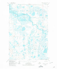
1951 Map of Naknek A-4
USGS Topo · Published 1978About this map
The Egegik River dominates this mid-century landscape as it winds through an extensive network of marshes and waterways. Surveyed in 1951, the area exhibits a primitive wilderness character where human presence is nearly non-existent, marked only by a lone Cabin situated in the southeastern reaches. The hydrology is incredibly complex, featuring the King Salmon River and the meandering course of the Swampy River, which feed into the primary flow.
Find a feature on this map
10 named features on this map. Tap any name to fly to it.
Don’t see what you’re looking for? This feature index may not catch every label — zoom into the map to look around manually.
Map Details
Editions of this 1951 Naknek A-4 Map
3 editions found
Other maps of this area

1943 · Ugashik
USGS Topo · 1:250,000

1948 · Ugashik
USGS Topo · 1:250,000

1949 · Ugashik
USGS Topo · 1:250,000

1951 · Ugashik D-5 and D-6
USGS Topo · 1:63,360

1951 · Ugashik D-3
USGS Topo · 1:63,360

1951 · Ugashik D-4
USGS Topo · 1:63,360

1951 · Naknek A-5
USGS Topo · 1:63,360

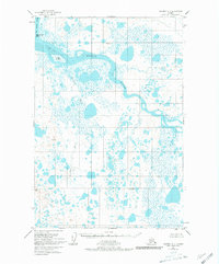
1951 · Naknek A-4
USGS Topo · 1:63,360

1951 · Naknek A-3
USGS Topo · 1:63,360

1952 · Naknek
USGS Topo · 1:250,000