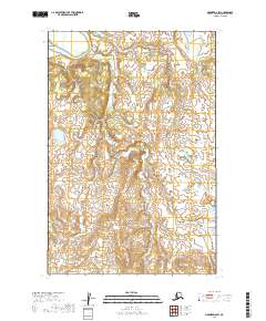
2019 Map of Naknek D-6 SW
USGS Topo · Published 2019About this map
The interior of the T15s R52w and T16s R52w townships in the Dillingham Census Area is defined by a complex network of small lakes and undulating terrain. This 2019 survey documents a landscape nearly devoid of modern infrastructure or established settlements, focusing instead on the hydrological patterns and elevation contours that characterize this subarctic environment. The lack of roads or buildings highlights the region's character as a wilderness area where the natural geography remains the primary feature. Researchers interested in the public land survey system will find the boundaries for T15s R51w and T16s R51w clearly delineated, providing a clear frame for the vast, water-dotted expanse that defines this portion of the Alaska Peninsula.
Find a feature on this map
4 named features on this map. Tap any name to fly to it.
Don’t see what you’re looking for? This feature index may not catch every label — zoom into the map to look around manually.
Map Details
Editions of this 2019 Naknek D-6 SW Map
This is the sole edition of this map. No revisions or reprints were ever made.
Other maps of this area

1945 · Nushagak Bay
USGS Topo · 1:250,000

1949 · Nushagak Bay
USGS Topo · 1:250,000

1951 · Nushagak Bay
USGS Topo · 1:250,000

1952 · Naknek
USGS Topo · 1:250,000
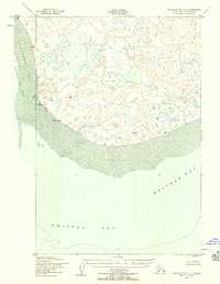
1952 · Nushagak Bay C-1
USGS Topo · 1:63,360

1952 · Naknek C-6
USGS Topo · 1:63,360

1952 · Nushagak Bay D-1
USGS Topo · 1:63,360

1952 · Naknek D-6
USGS Topo · 1:63,360

1964 · Nushagak Bay
USGS Topo · 1:250,000

1964 · Naknek
USGS Topo · 1:250,000