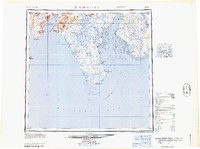
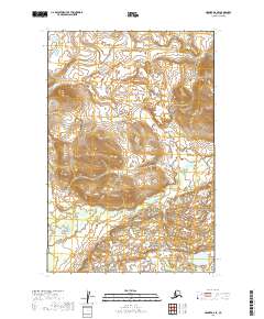
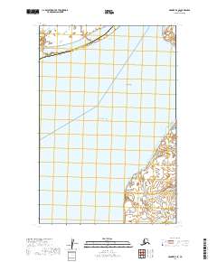
1964 Map of Nushagak Bay
USGS Topo · Published 1964About this map
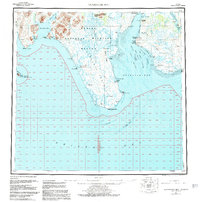
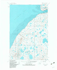
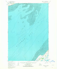
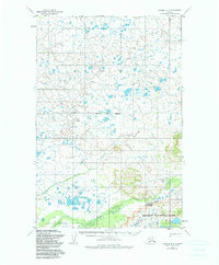
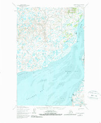
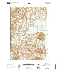
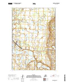
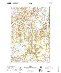
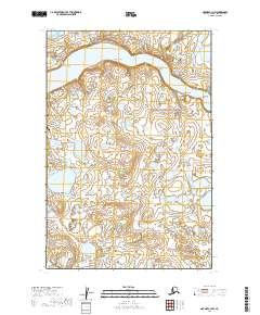
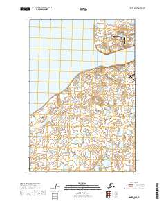
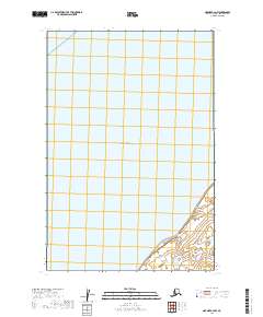
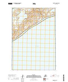
Nushagak Bay and its complex network of tidal flats and channels define this 1964 maritime and coastal survey. The map details a critical intersection of the Alaskan fishing industry, highlighting several Canneries and settlements like Clarks Point and Ekuk along the eastern shore. To the west, the Nushagak Peninsula terminates at Cape Constantine, separating the main bay from the open waters of Bristol Bay. The geography is characterized by dramatic coastal features, including the Ekuk Spit and Igushik Ridge, which provide a backdrop to the drainage systems of the Wood River and Igushik River. Navigational data reflects the era's reliance on water transport, with identified channels like the Ship Channel and Schooner Channel providing passage through the shifting Long Sands and Flounder Flat. Inland, the survey reaches to Manokotak and the peaks of the Tuklungs, documenting the sparse but vital infrastructure of the Bristol Bay region.
Find a feature on this map
53 named features on this map. Tap any name to fly to it.
Don’t see what you’re looking for? This feature index may not catch every label — zoom into the map to look around manually.
Map Details
Editions of this 1964 Nushagak Bay Map
This is the sole edition of this map. No revisions or reprints were ever made.
Historical Maps of Dillingham Through Time
25 maps found

1945 Nushagak Bay
Bristol Bay Borough, AK

1949 Nushagak Bay
Bristol Bay Borough, AK
1951 Nushagak Bay
Bristol Bay Borough, AK
1952 Naknek C-2
Bristol Bay Borough, AK
1952 Naknek C-3
Bristol Bay Borough, AK
1952 Naknek C-4
Bristol Bay Borough, AK
1952 Naknek C-5
Bristol Bay Borough, AK
1952 Naknek D-2
Bristol Bay Borough, AK

1952 Naknek D-3
Bristol Bay Borough, AK
1952 Naknek D-4
Bristol Bay Borough, AK
1964 Nushagak Bay
Bristol Bay Borough, AK
2019 Naknek C-2 NE
Bristol Bay Borough, AK
2019 Naknek C-2 NW
Bristol Bay Borough, AK
2019 Naknek C-3 NE
Bristol Bay Borough, AK
2019 Naknek C-3 NW
Bristol Bay Borough, AK
2019 Naknek C-4 NE
Bristol Bay Borough, AK
2019 Naknek C-4 NW
Bristol Bay Borough, AK
2019 Naknek C-5 NW
Bristol Bay Borough, AK
2019 Naknek C-6 NE
Bristol Bay Borough, AK
2019 Naknek D-2 SE
Bristol Bay Borough, AK
2019 Naknek D-2 SW
Bristol Bay Borough, AK
2019 Naknek D-3 SE
Bristol Bay Borough, AK
2019 Naknek D-3 SW
Bristol Bay Borough, AK
2019 Naknek D-4 SE
Bristol Bay Borough, AK
2019 Naknek D-4 SW
Bristol Bay Borough, AK