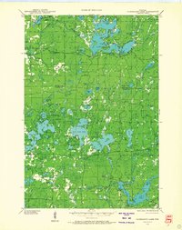
1943 Map of Namekagon Lake
USGS Topo · Published 1968About this map
Chequamegon National Forest dominates this northern landscape, which was being actively managed during the early 1940s through infrastructure like the Sawyer CCC Camp and the West Fork Fire Tower. The area is defined by a dense network of glacial lakes and wetlands, most notably the expansive Namekagon Lake with its numerous islands and points, including Anderson Island and Missionary Point.
Find a feature on this map
108 named features on this map. Tap any name to fly to it.
Don’t see what you’re looking for? This feature index may not catch every label — zoom into the map to look around manually.
Map Details
Editions of this 1943 Namekagon Lake Map
2 editions found
Other maps of this area

1942 · Clam Lake
USGS Topo · 1:48,000

1942 · Marengo
USGS Topo · 1:48,000

1943 · Namekagon Lake
USGS Topo · 1:48,000

1944 · Draper
USGS Topo · 1:48,000

1944 · Couderay
USGS Topo · 1:48,000

1944 · Radisson
USGS Topo · 1:48,000

1944 · Drummond
USGS Topo · 1:48,000

1944 · Grandview
USGS Topo · 1:48,000

1944 · Hayward
USGS Topo · 1:48,000

1945 · Namekagon Lake
USGS Topo · 1:48,000