
1978 Map of Namur
USGS Topo · Published 1979About this map
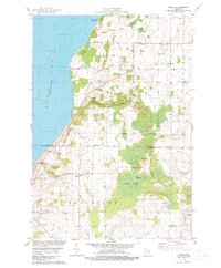
The Belgian heritage of Southern Door County is visible across this late-1970s landscape, centered on the settlement of Namur. The map captures a rural Peninsula community defined by its proximity to Green Bay and the drainage of Sugar Creek and Macco Creek. Local life is anchored by traditional sites like St Marys Cem and St Francis Ch, while the shoreline features recreation at Chaudoirs Dock County Park and Shoemaker Point. The interior transitions from open fields to the dense wetlands of Duvall Swamp and the small waters of Little Mud Lake. The prevalence of several Gravel Pits suggests the importance of local material extraction for the region's infrastructure. In the southern reaches, the Red River cuts through the terrain near the settlement of Duvall, providing a natural boundary near the Door Co Kewaunee Co line.
Find a feature on this map
42 named features on this map. Tap any name to fly to it.
Don’t see what you’re looking for? This feature index may not catch every label — zoom into the map to look around manually.
Map Details
Editions of this 1978 Namur Map
2 editions found
Other maps of this area

1952 · Casco
USGS Topo · 1:62,500

1954 · New Franken
USGS Topo · 1:62,500

1954 · Manitowoc
USGS Topo · 1:250,000

1956 · Oconto
USGS Topo · 1:62,500

1958 · Manitowoc
USGS Topo · 1:250,000

1961 · Little Sturgeon
USGS Topo · 1:62,500
1974 · Oconto SE
USGS Topo · 1:24,000

1978 · Casco
USGS Topo · 1:24,000
1978 · Luxemburg
USGS Topo · 1:24,000

1978 · Brussels
USGS Topo · 1:24,000