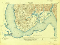
1913 Map of Nanjemoy
USGS Topo · Published 1945About this map
The Potomac River defines the western and southern reaches of this Maryland shoreline, where numerous landings and wharves once facilitated local commerce before the modernization of the road network. This landscape is deeply etched by a network of waterways including Nanjemoy Creek, Beaverdam Run, and the Port Tobacco River, which divide the land into distinct points and necks such as Taylor Neck and Cedar Point Neck.
Find a feature on this map
82 named features on this map. Tap any name to fly to it.
Don’t see what you’re looking for? This feature index may not catch every label — zoom into the map to look around manually.
Map Details
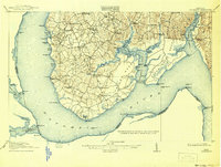
Editions of this 1913 Nanjemoy Map
3 editions found

Other maps of this area

1889 · Fredericksburg
USGS Topo · 1:125,000

1890 · Mt. Vernon
USGS Topo · 1:125,000

1891 · Mt. Vernon
USGS Topo · 1:125,000

1892 · Fredericksburg
USGS Topo · 1:125,000

1892 · Brandywine
USGS Topo · 1:62,500

1894 · Wicomico
USGS Topo · 1:62,500

1894 · Fredericksburg
USGS Topo · 1:125,000

1894 · Mt. Vernon
USGS Topo · 1:125,000

1895 · Wicomico
USGS Topo · 1:62,500

1895 · Brandywine
USGS Topo · 1:62,500