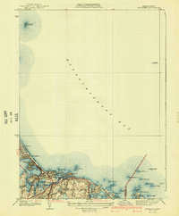
1941 Map of Nantasket
USGS Topo · Published 1941About this map
Nantasket Beach and the jagged coastline of the South Shore define this pre-war maritime landscape surveyed in 1936. The map illustrates a developed coastal corridor where residential and recreational spaces like the Cohasset Golf Club meet the Atlantic. Dense clusters of settlements at Nantasket, North Cohasset, and Green Hill are connected by iconic thoroughfares including Jerusalem Road and Atlantic Avenue.
Find a feature on this map
41 named features on this map. Tap any name to fly to it.
Don’t see what you’re looking for? This feature index may not catch every label — zoom into the map to look around manually.
Map Details
Editions of this 1941 Nantasket Map
3 editions found
Other maps of this area

1885 · Abington
USGS Topo · 1:62,500

1885 · Duxbury
USGS Topo · 1:62,500

1888 · Duxbury
USGS Topo · 1:62,500

1888 · Abington
USGS Topo · 1:62,500

1892 · Boston Bay
USGS Topo · 1:62,500

1893 · Abington
USGS Topo · 1:62,500

1893 · Duxbury
USGS Topo · 1:62,500

1903 · Boston Bay
USGS Topo · 1:62,500

1918 · Duxbury
USGS Topo · 1:62,500

1920 · Abington
USGS Topo · 1:62,500