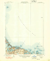
1941 Map of Nantasket
USGS Topo · Published 1949About this map
Massachusetts Bay defines the character of this coastal survey, where the rugged South Shore meets the Atlantic. The shoreline is punctuated by a dense collection of named ledges, rocks, and points, from The Graves in the north to the iconic Minots Ledge Lighthouse and The Glades at the southern edge. The map captures the specialized geography of the era, noting the position of the Boston Lightship and the complex waterways of Little Harbor and the Weir River.
Find a feature on this map
40 named features on this map. Tap any name to fly to it.
Don’t see what you’re looking for? This feature index may not catch every label — zoom into the map to look around manually.
Map Details
Editions of this 1941 Nantasket Map
3 editions found
Other maps of this area

1885 · Abington
USGS Topo · 1:62,500

1885 · Duxbury
USGS Topo · 1:62,500

1888 · Duxbury
USGS Topo · 1:62,500

1888 · Abington
USGS Topo · 1:62,500

1892 · Boston Bay
USGS Topo · 1:62,500

1893 · Abington
USGS Topo · 1:62,500

1893 · Duxbury
USGS Topo · 1:62,500

1903 · Boston Bay
USGS Topo · 1:62,500

1918 · Duxbury
USGS Topo · 1:62,500

1920 · Abington
USGS Topo · 1:62,500