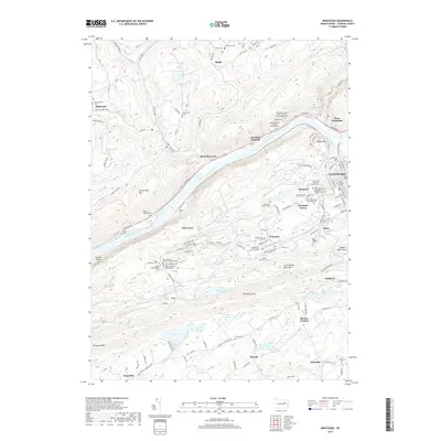
2019 Map of Nanticoke
USGS Topo · Published 2019About this map
The Susquehanna River carves a deep valley through the ridges of Luzerne County, separating Shickshinny Mtn from the industrial corridors of Glen Lyon and Wanamie. This survey reflects the dense cultural geography of the Wyoming Valley, marked by an extraordinary concentration of ethnic and denominational burial grounds such as the Saint Nicholas Ukrainian Catholic Cem and Exaltation of the Holy Cross and Saint Josephs Cem. These sites, along with the Saint Stanislaus Orphanage Cem, provide a spatial record of the immigrant communities that fueled the region's development.
Find a feature on this map
149 named features on this map. Tap any name to fly to it.
Don’t see what you’re looking for? This feature index may not catch every label — zoom into the map to look around manually.
Map Details
Editions of this 2019 Nanticoke Map
This is the sole edition of this map. No revisions or reprints were ever made.
Other maps of this area

1891 · Wilkesbarre
USGS Topo · 1:62,500

1891 · Harveys Lake
USGS Topo · 1:62,500

1893 · Harvey Lake
USGS Topo · 1:62,500

1893 · Pittston
USGS Topo · 1:62,500

1894 · Shickshinny
USGS Topo · 1:62,500

1894 · Wilkesbarre
USGS Topo · 1:62,500

1943 · Scranton
USGS Topo · 1:125,000

1946 · Sybertsville
USGS Topo · 1:31,680

1946 · Nanticoke
USGS Topo · 1:31,680

1946 · Shickshinny
USGS Topo · 1:31,680