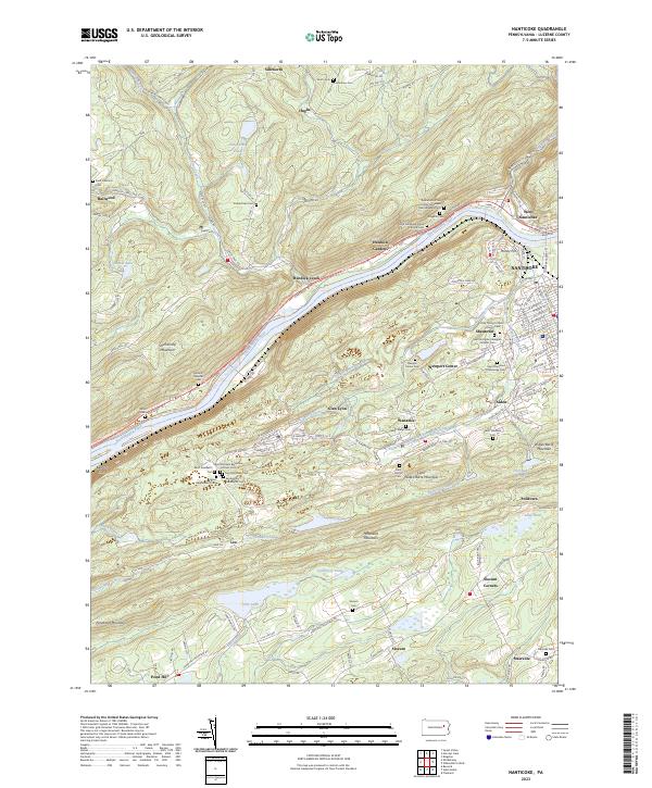
2023 Map of Nanticoke
USGS Topo · Published 2023About this map
The Susquehanna River carves a deep valley through the ridges of Luzerne County, separating the steep slopes of Shickshinny Mountain from the dense industrial and residential corridors of Nanticoke and West Nanticoke. This landscape is defined by its deep cultural roots, evidenced by an extraordinary density of ethnic and parochial cemeteries. Clusters such as the Italian Independent Cem, Saint Michaels Byzantine Catholic Cem, and the Good Shepherd Polish National Cem reflect the immigrant communities that settled these anthracite coal regions.
Find a feature on this map
156 named features on this map. Tap any name to fly to it.
Don’t see what you’re looking for? This feature index may not catch every label — zoom into the map to look around manually.
Map Details
Editions of this 2023 Nanticoke Map
This is the sole edition of this map. No revisions or reprints were ever made.
Other maps of this area

1891 · Wilkesbarre
USGS Topo · 1:62,500

1891 · Harveys Lake
USGS Topo · 1:62,500

1893 · Harvey Lake
USGS Topo · 1:62,500

1893 · Pittston
USGS Topo · 1:62,500

1894 · Shickshinny
USGS Topo · 1:62,500

1894 · Wilkesbarre
USGS Topo · 1:62,500

1943 · Scranton
USGS Topo · 1:125,000

1946 · Sybertsville
USGS Topo · 1:31,680

1946 · Nanticoke
USGS Topo · 1:31,680

1946 · Shickshinny
USGS Topo · 1:31,680