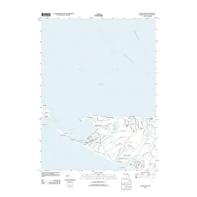
2012 Map of Nantucket
USGS Topo · Published 2012About this map
Madaket and the western reaches of Nantucket Island are defined by a complex network of coastal ponds and shifting sands in this 2012 survey. The landscape transitions from the protected waters of Madaket Harbor to the Atlantic surf at Cisco Beach, with large interior water bodies like Long Pond and Hummock Pond dominating the central terrain. Navigation remains a primary theme of the area, evidenced by the Tuckernuck Island South East Light and the charted paths of the Hyannis - Nantucket Ferry Crossing. Residential clusters at Fishers Landing and Warren Landing connect via narrow ways like Eel Point Rd and Madaket Rd. Historic coastal features including Smith Point and the isolated Esther Island show the environmental vulnerability of this coastal margin, where maritime infrastructure and seasonal settlements meet the open ocean.
Find a feature on this map
95 named features on this map. Tap any name to fly to it.
Don’t see what you’re looking for? This feature index may not catch every label — zoom into the map to look around manually.
Map Details
Editions of this 2012 Nantucket Map
This is the sole edition of this map. No revisions or reprints were ever made.
Other maps of this area

1887 · Muskeget
USGS Topo · 1:62,500

1889 · Muskeget
USGS Topo · 1:62,500

1889 · Nantucket
USGS Topo · 1:62,500

1893 · Nantucket
USGS Topo · 1:62,500

1893 · Muskeget
USGS Topo · 1:62,500

1899 · Muskeget
USGS Topo · 1:62,500

1901 · Nantucket
USGS Topo · 1:62,500

1942 · Nantucket
USGS Topo · 1:125,000

1944 · Tuckernuck Island
USGS Topo · 1:31,680

1945 · Nantucket
USGS Topo · 1:31,680