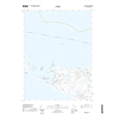
2018 Map of Nantucket
USGS Topo · Published 2018About this map
The settlement of Madaket stands as the western gateway to the island, where the land narrows toward the distinctive spit of Eel Point. This coastal landscape is defined by its complex hydrology, featuring numerous isolated water bodies like Sheep Pond and Rotten Pumpkin Pond that sit just inland from the Atlantic Ocean. The presence of the Founders Burial Ground near Maxcy Pond provides a significant genealogical anchor, marking the early colonial history of the area.
Find a feature on this map
55 named features on this map. Tap any name to fly to it.
Don’t see what you’re looking for? This feature index may not catch every label — zoom into the map to look around manually.
Map Details
Editions of this 2018 Nantucket Map
This is the sole edition of this map. No revisions or reprints were ever made.
Other maps of this area

1887 · Muskeget
USGS Topo · 1:62,500

1889 · Muskeget
USGS Topo · 1:62,500

1889 · Nantucket
USGS Topo · 1:62,500

1893 · Nantucket
USGS Topo · 1:62,500

1893 · Muskeget
USGS Topo · 1:62,500

1899 · Muskeget
USGS Topo · 1:62,500

1901 · Nantucket
USGS Topo · 1:62,500

1942 · Nantucket
USGS Topo · 1:125,000

1944 · Tuckernuck Island
USGS Topo · 1:31,680

1945 · Nantucket
USGS Topo · 1:31,680