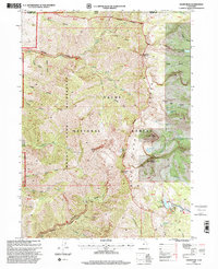
1998 Map of Naomi Peak
USGS Topo · Published 2001About this map
Naomi Peak rises as the central landmark within the Mount Naomi Wilderness, marking a high point in the Bear River Range along the Utah-Idaho border. This 1998 revision of the earlier 1981 survey reveals a landscape defined by dramatic glacial cirques and high-altitude basins, including those holding White Pine Lake and Tony Grove Lake. The map details a sophisticated network of water resources and recreational infrastructure, from the Tony Grove Lake Campground and its associated Tony Grove Nature Trail to the more secluded Steam Mill Lake.
Find a feature on this map
41 named features on this map. Tap any name to fly to it.
Don’t see what you’re looking for? This feature index may not catch every label — zoom into the map to look around manually.
Map Details
Editions of this 1998 Naomi Peak Map
This is the sole edition of this map. No revisions or reprints were ever made.
Other maps of this area

1914 · Logan
USGS Topo · 1:125,000

1915 · Preston
USGS Topo · 1:96,000

1916 · Logan
USGS Topo · 1:125,000

1918 · Preston
USGS Topo · 1:125,000

1954 · Ogden
USGS Topo · 1:250,000

1955 · Preston
USGS Topo · 1:250,000

1958 · Ogden
USGS Topo · 1:250,000

1958 · Preston
USGS Topo · 1:250,000

1960 · Ogden
USGS Topo · 1:250,000

1962 · Preston
USGS Topo · 1:250,000