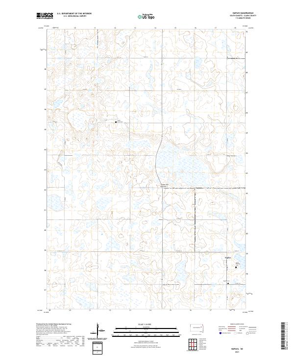
2021 Map of Naples
USGS Topo · Published 2021About this map
Naples sits at the heart of this agricultural landscape within the Coteau des Prairies, an elevated plateau region defined by its high density of wetlands and glacial depressions. This 2021 survey by the U.S. Geological Survey documents the rural character of Clark County, where the settlement pattern is anchored by small community hubs and local cemeteries. Genealogists can find the locations of Saint Patricks Cem, Naples Cem, and the South Elrod Cem, which are scattered among the section lines and township boundaries. The terrain is marked by a complex network of unnamed sloughs and seasonal water bodies, typical of this prairie pothole region. Local infrastructure is primarily defined by a grid of county roads, including Co RD 9 and Co RD 34, which connect the dispersed farmsteads of the eastern South Dakota plains.
Find a feature on this map
20 named features on this map. Tap any name to fly to it.
Don’t see what you’re looking for? This feature index may not catch every label — zoom into the map to look around manually.
Map Details
Editions of this 2021 Naples Map
This is the sole edition of this map. No revisions or reprints were ever made.
Other maps of this area

1953 · Watertown
USGS Topo · 1:250,000

1958 · Watertown
USGS Topo · 1:250,000

1973 · Garden City
USGS Topo · 1:24,000
1973 · Henry
USGS Topo · 1:24,000

1973 · Willow Lake
USGS Topo · 1:24,000

1973 · Clark South
USGS Topo · 1:24,000
1973 · Clark North
USGS Topo · 1:24,000

1973 · Vienna West
USGS Topo · 1:24,000

1973 · Naples
USGS Topo · 1:24,000

1973 · Vienna East
USGS Topo · 1:24,000