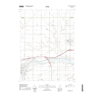
2019 Map of Napoleon East
USGS Topo · Published 2019About this map
The Maumee River corridor defines this portion of Henry County, anchoring the regional geography as it flows through the southeastern corner of Napoleon. This 2019 survey documents the city's eastern growth, centered around the Henry County Courthouse and a dense network of local streets such as E Main St and E Clinton St. North of the river, the landscape transitions into a grid of agricultural land and tributaries, including Dry Cr and N Turkeyfoot Cr, which lead toward the village of Liberty Center. Historical markers are plentiful across the terrain, with numerous family and community burial grounds like Forest Hill Cem, Damascus Cem, and Young Cem providing essential data for local historians. Modern infrastructure is represented by the Henry County Airport and the N Country National Scenic Trail, which traces the river's edge.
Find a feature on this map
35 named features on this map. Tap any name to fly to it.
Don’t see what you’re looking for? This feature index may not catch every label — zoom into the map to look around manually.
Map Details
Editions of this 2019 Napoleon East Map
This is the sole edition of this map. No revisions or reprints were ever made.
Other maps of this area

1908 · Napoleon
USGS Topo · 1:62,500

1909 · Mc Clure
USGS Topo · 1:62,500

1911 · Wauseon
USGS Topo · 1:62,500

1911 · Swanton
USGS Topo · 1:62,500

1913 · Wauseon
USGS Topo · 1:62,500

1914 · Swanton
USGS Topo · 1:62,500

1943 · Wauseon
USGS Topo · 1:62,500

1953 · Fort Wayne
USGS Topo · 1:250,000

1956 · Fort Wayne
USGS Topo · 1:250,000

1956 · Toledo
USGS Topo · 1:250,000