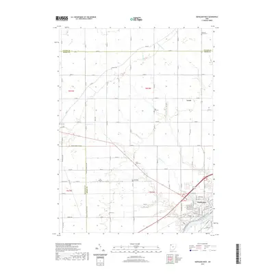
2019 Map of Napoleon West
USGS Topo · Published 2019About this map
The Maumee River winds through the southeastern corner of this Henry County landscape, serving as a primary geographical anchor for the city of Napoleon. This area, characterized by its traditional Midwestern section-line road grid, reveals a dense network of rural infrastructure including Defiance Henry Co Line Rd and numerous township routes that connect isolated settlements like Gerald. The survey is particularly valuable for genealogical research, as it identifies several small, family-linked burial sites and churchyards dispersed throughout the agricultural fields, such as Bremer Cem, Freedom Cem, and Union Chapel Cem.
Find a feature on this map
90 named features on this map. Tap any name to fly to it.
Don’t see what you’re looking for? This feature index may not catch every label — zoom into the map to look around manually.
Map Details
Editions of this 2019 Napoleon West Map
This is the sole edition of this map. No revisions or reprints were ever made.
Other maps of this area

1907 · Defiance
USGS Topo · 1:62,500

1908 · Napoleon
USGS Topo · 1:62,500

1909 · Defiance
USGS Topo · 1:62,500

1911 · Wauseon
USGS Topo · 1:62,500

1913 · Wauseon
USGS Topo · 1:62,500

1913 · Alvordton
USGS Topo · 1:62,500

1943 · Wauseon
USGS Topo · 1:62,500

1944 · Alvordton
USGS Topo · 1:62,500

1953 · Fort Wayne
USGS Topo · 1:250,000

1956 · Fort Wayne
USGS Topo · 1:250,000