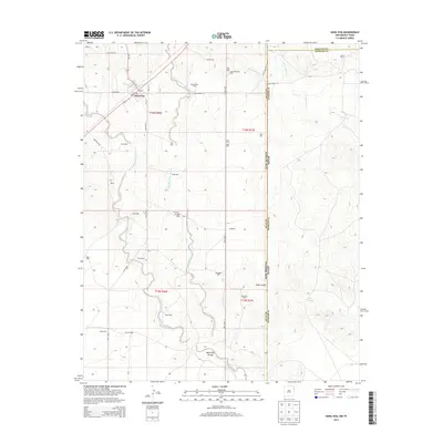
2013 Map of Nara Visa
USGS Topo · Published 2013About this map
Nara Visa sits at a geographic crossroads on the high plains where the New Mexico-Texas border meets the Hartley and Oldham county lines. This ranching landscape is defined by the dendritic drainage of the Nara Visa Arroyo and its multiple branches, including the W Fork and E Fork. Settled life in this arid environment is evidenced by a dense network of family-named wells and ranches, such as Bravo Ranch and McAllister. The grid of secondary roads like Quay Road 93 and NM-402 connects isolated settlements such as Burris and Burns to the village center. To the east, the terrain breaks into the drainage of Horse Cr and the topographical relief of Sidle Canyon, where Sidle Spring provides a rare natural water source amidst the numerous man-made bores like Jones Well and Greenhouse Well.
Find a feature on this map
56 named features on this map. Tap any name to fly to it.
Don’t see what you’re looking for? This feature index may not catch every label — zoom into the map to look around manually.
Map Details
Editions of this 2013 Nara Visa Map
This is the sole edition of this map. No revisions or reprints were ever made.
Other maps of this area

1954 · Tucumcari
USGS Topo · 1:250,000

1958 · Tucumcari
USGS Topo · 1:250,000

1966 · Trujillo Camp
USGS Topo · 1:24,000

1968 · Cammak Camp
USGS Topo · 1:24,000

1968 · Sanchez Springs
USGS Topo · 1:24,000

1971 · Kerlin Hill
USGS Topo · 1:24,000

1971 · Doyle Hill
USGS Topo · 1:24,000

1971 · Obar
USGS Topo · 1:24,000

1971 · Nara Visa
USGS Topo · 1:24,000

1971 · Knoblaw
USGS Topo · 1:24,000