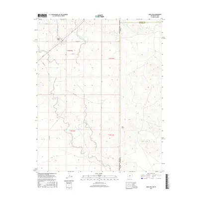
2017 Map of Nara Visa
USGS Topo · Published 2017About this map
Nara Visa sits at the intersection of high plains history and modern topography, situated in the northeastern corner of Quay County along the border of the Texas Panhandle. This landscape is defined by the complex drainage systems that carve through the arid terrain, notably the West Fork Nara Visa Arroyo and East Fork Nara Visa Arroyo. These waterways, along with Nara Visa Arroyo itself, create a distinctive geographic footprint for the settlement, which is linked by historic thoroughfares like Bell St and Quay Road 93. Further east, the terrain becomes more varied as it descends toward Sidle Canyon, where Sidle Spring provides a rare point of named water. The map captures the meeting point of New Mexico and Texas, as well as the county line between Quay, Oldham, and Hartley, illustrating the administrative and physical boundaries of this borderland region.
Find a feature on this map
27 named features on this map. Tap any name to fly to it.
Don’t see what you’re looking for? This feature index may not catch every label — zoom into the map to look around manually.
Map Details
Editions of this 2017 Nara Visa Map
This is the sole edition of this map. No revisions or reprints were ever made.
Other maps of this area

1954 · Tucumcari
USGS Topo · 1:250,000

1958 · Tucumcari
USGS Topo · 1:250,000

1966 · Trujillo Camp
USGS Topo · 1:24,000

1968 · Cammak Camp
USGS Topo · 1:24,000

1968 · Sanchez Springs
USGS Topo · 1:24,000

1971 · Kerlin Hill
USGS Topo · 1:24,000

1971 · Doyle Hill
USGS Topo · 1:24,000

1971 · Obar
USGS Topo · 1:24,000

1971 · Nara Visa
USGS Topo · 1:24,000

1971 · Knoblaw
USGS Topo · 1:24,000