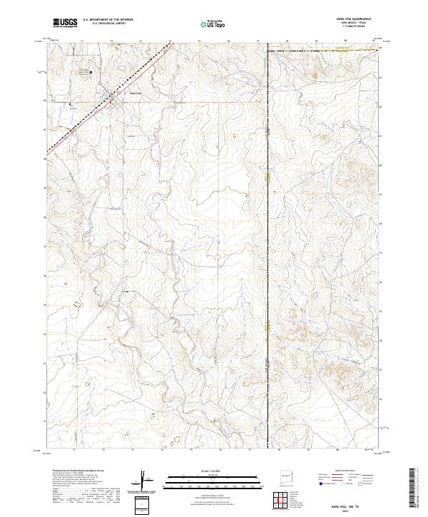
2023 Map of Nara Visa
USGS Topo · Published 2023About this map
Nara Visa stands as a focal point on this eastern New Mexico plains landscape, situated near the intersection of Bell St and King St. This community serves as a local hub amidst a high-desert terrain defined by numerous drainages, including the Nara Visa Arroyo and its tributaries, the East Fork and West Fork. Genealogists and local historians will find value in the documentation of the Independent Order of Odd Fellows Cemetery and the Nara Vista Cemetery, which provide a physical record of the area's early residents. The northeastern portion of the map transition into Texas, where the terrain descends toward Horse Creek and its branches, the North Fork and South Fork. To the south, Sidle Canyon and Sidle Spring offer evidence of water sources that historically anchored ranching or early travel in this borderland region.
Find a feature on this map
32 named features on this map. Tap any name to fly to it.
Don’t see what you’re looking for? This feature index may not catch every label — zoom into the map to look around manually.
Map Details
Editions of this 2023 Nara Visa Map
This is the sole edition of this map. No revisions or reprints were ever made.
Other maps of this area

1954 · Tucumcari
USGS Topo · 1:250,000

1958 · Tucumcari
USGS Topo · 1:250,000

1966 · Trujillo Camp
USGS Topo · 1:24,000

1968 · Cammak Camp
USGS Topo · 1:24,000

1968 · Sanchez Springs
USGS Topo · 1:24,000

1971 · Kerlin Hill
USGS Topo · 1:24,000

1971 · Doyle Hill
USGS Topo · 1:24,000

1971 · Obar
USGS Topo · 1:24,000

1971 · Nara Visa
USGS Topo · 1:24,000

1971 · Knoblaw
USGS Topo · 1:24,000