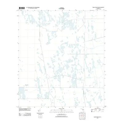
2012 Map of Narcoossee SE
USGS Topo · Published 2012About this map
The Old Railroad Grade Rd cuts through a landscape dominated by complex wetland systems in this Florida interior region. The terrain is characterized by a dense network of water bodies, including Hell Bays in the north and the expansive Sawgrass Slough to the south. Small, isolated pools like Islet Pond, Maple Head Pond, and Otter Pond pepper the central portion of the map, suggesting a slow-moving, interconnected drainage pattern typical of the Florida peninsula.
Find a feature on this map
16 named features on this map. Tap any name to fly to it.
Don’t see what you’re looking for? This feature index may not catch every label — zoom into the map to look around manually.
Map Details
Editions of this 2012 Narcoossee SE Map
This is the sole edition of this map. No revisions or reprints were ever made.
Other maps of this area

1953 · Narcoossee NE
USGS Topo · 1:24,000

1953 · Narcoossee SE
USGS Topo · 1:24,000

1953 · Narcoossee
USGS Topo · 1:24,000

1953 · Deer Park NW
USGS Topo · 1:24,000

1953 · Lake Poinsett SW
USGS Topo · 1:24,000

1953 · Ashton
USGS Topo · 1:24,000

1953 · Holopaw
USGS Topo · 1:24,000

1953 · Lake Poinsett NW
USGS Topo · 1:24,000

1953 · Narcoossee NW
USGS Topo · 1:24,000

1955 · Orlando
USGS Topo · 1:250,000