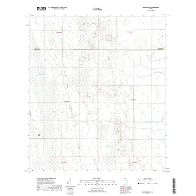
2018 Map of Narcoossee SE
USGS Topo · Published 2018About this map
Econlockhatchee River Swamp and a network of shallow basins dominate this corner of Central Florida along the boundary between Orange Co and Osceola Co. The terrain is defined by low-lying wetlands and sluggish drainage systems such as Fourmile Swamp, Bee Tree Swamp, and Sawgrass Slough. Human settlement and activity are concentrated around the Storey Bend area and the small LM-ETS Airport to the north. Historical land use patterns are visible through the local road network, including the diagonal Tram Rd and the east-west corridor of Co Rd 532. The map details a hydrologically sensitive landscape where small water bodies like Maple Head Pond and Otter Pond pepper the pine flatwoods, and the upper reaches of the N Fork Taylor Cr begin to take shape.
Find a feature on this map
29 named features on this map. Tap any name to fly to it.
Don’t see what you’re looking for? This feature index may not catch every label — zoom into the map to look around manually.
Map Details
Editions of this 2018 Narcoossee SE Map
This is the sole edition of this map. No revisions or reprints were ever made.
Other maps of this area

1953 · Narcoossee NE
USGS Topo · 1:24,000

1953 · Narcoossee SE
USGS Topo · 1:24,000

1953 · Narcoossee
USGS Topo · 1:24,000

1953 · Deer Park NW
USGS Topo · 1:24,000

1953 · Lake Poinsett SW
USGS Topo · 1:24,000

1953 · Ashton
USGS Topo · 1:24,000

1953 · Holopaw
USGS Topo · 1:24,000

1953 · Lake Poinsett NW
USGS Topo · 1:24,000

1953 · Narcoossee NW
USGS Topo · 1:24,000

1955 · Orlando
USGS Topo · 1:250,000