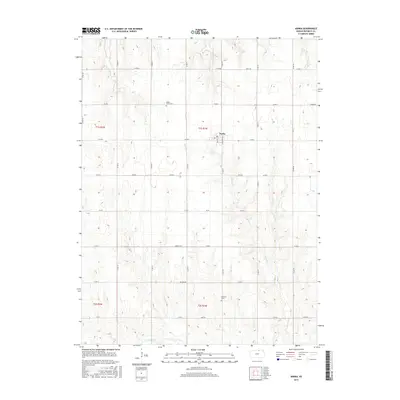
2015 Map of Narka
USGS Topo · Published 2015About this map
Narka sits at the heart of this Republic County landscape, a town defined by its grid of Main St and Cottonwood St. This 2015 survey reveals a quiet agricultural region where the headwaters of numerous streams, including Humphrey Br, Elm Cr, and Cherry Cr, carve a network of drainage patterns across the terrain. For those researching family heritage in north-central Kansas, the map serves as a precise guide to local landmarks like Maple Grove Cem and National Cem. The landscape is methodically organized by a section-line road system, with routes like Hickory Rd and Jade Rd framing the rural plots. The southwestern corner is particularly well-watered by the meandering path of N Fork Mill Cr, illustrating the vital connection between these small plains communities and their local water sources.
Find a feature on this map
35 named features on this map. Tap any name to fly to it.
Don’t see what you’re looking for? This feature index may not catch every label — zoom into the map to look around manually.
Map Details
Editions of this 2015 Narka Map
This is the sole edition of this map. No revisions or reprints were ever made.
Other maps of this area

1892 · Concordia
USGS Topo · 1:125,000

1893 · Washington
USGS Topo · 1:125,000

1898 · Hebron
USGS Topo · 1:125,000

1955 · Manhattan
USGS Topo · 1:250,000

1955 · Lincoln
USGS Topo · 1:250,000

1956 · Manhattan
USGS Topo · 1:250,000

1957 · Manhattan
USGS Topo · 1:250,000

1957 · Lincoln
USGS Topo · 1:250,000

1958 · Lincoln
USGS Topo · 1:250,000

1960 · Chester
USGS Topo · 1:24,000