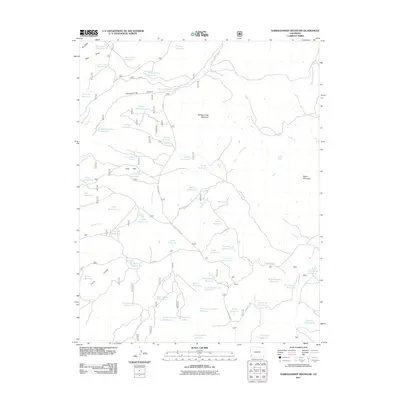
2011 Map of Narraguinnep Mountain
USGS Topo · Published 2011About this map
Narraguinnep Mountain anchors this high-elevation landscape in southwestern Colorado, a region defined by complex water management and rugged topography. The terrain is marked by a vast network of irrigation and storage features, including the large Narraguinnep Reservoir and numerous smaller, family-named or locality-based basins such as Koppenhafer Reservoir, Hosea Reservoir, and Summers Reservoir. These water sources are vital to the dry high-desert environment, supporting the livestock and agricultural needs of the surrounding area.
Find a feature on this map
66 named features on this map. Tap any name to fly to it.
Don’t see what you’re looking for? This feature index may not catch every label — zoom into the map to look around manually.
Map Details
Editions of this 2011 Narraguinnep Mountain Map
This is the sole edition of this map. No revisions or reprints were ever made.
Other maps of this area

1956 · Cortez
USGS Topo · 1:250,000

1958 · Cortez
USGS Topo · 1:250,000

1959 · Cortez
USGS Topo · 1:250,000

1962 · Cortez
USGS Topo · 1:250,000

1964 · Glade Mountain
USGS Topo · 1:24,000

1964 · The Glade
USGS Topo · 1:24,000
1964 · South Mountain
USGS Topo · 1:24,000

1965 · Willow Spring
USGS Topo · 1:24,000

1965 · Yellow Jacket
USGS Topo · 1:24,000
1965 · Boggy Draw
USGS Topo · 1:24,000