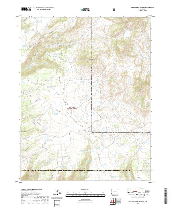
2022 Map of Narraguinnep Mountain
USGS Topo · Published 2022About this map
The San Juan National Forest defines the character of this landscape in southwestern Colorado, where the high mesa country meets complex drainage systems. A dense network of man-made water features, including Near Draw Reservoir, Brumley Reservoir, and Koppenhafer Reservoir, speaks to the critical importance of water management for local agriculture and livestock in this arid environment. The map details the border between Dolores County and Montezuma County, illustrating how political boundaries overlay the natural topography of Narraguinnep Mtn and Narraguinnep Canyon. Named landmarks such as Glade Ranch and several springs, including Indian Spring, indicate established human presence and reliance on specific water sources. The terrain is marked by a series of distinct ridges and draws, with Bench Mark Mtn and Elston Mtn serving as prominent elevations overlooking a system of access roads like Glade Road and Dry Lake Cutoff.
Find a feature on this map
91 named features on this map. Tap any name to fly to it.
Don’t see what you’re looking for? This feature index may not catch every label — zoom into the map to look around manually.
Map Details
Editions of this 2022 Narraguinnep Mountain Map
This is the sole edition of this map. No revisions or reprints were ever made.
Other maps of this area

1956 · Cortez
USGS Topo · 1:250,000

1958 · Cortez
USGS Topo · 1:250,000

1959 · Cortez
USGS Topo · 1:250,000

1962 · Cortez
USGS Topo · 1:250,000

1964 · Glade Mountain
USGS Topo · 1:24,000

1964 · The Glade
USGS Topo · 1:24,000
1964 · South Mountain
USGS Topo · 1:24,000

1965 · Willow Spring
USGS Topo · 1:24,000

1965 · Yellow Jacket
USGS Topo · 1:24,000
1965 · Boggy Draw
USGS Topo · 1:24,000