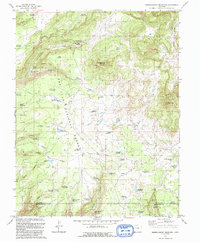
1993 Map of Narraguinnep Mountain
USGS Topo · Published 1993About this map
Fort Narraguinnep Historical Site serves as a focal point for this high-altitude landscape in the San Juan National Forest, where the complex water management of the Colorado plateau is clearly visible. The terrain is defined by dramatic cuts like Narraguinnep Canyon and Cabin Canyon, while a dense network of small catchments such as Brumley Reservoir and Hosea Reservoir illustrate how early ranchers and land managers captured seasonal runoff in the high country.
Find a feature on this map
59 named features on this map. Tap any name to fly to it.
Don’t see what you’re looking for? This feature index may not catch every label — zoom into the map to look around manually.
Map Details
Editions of this 1993 Narraguinnep Mountain Map
This is the sole edition of this map. No revisions or reprints were ever made.
Other maps of this area

1956 · Cortez
USGS Topo · 1:250,000

1958 · Cortez
USGS Topo · 1:250,000

1959 · Cortez
USGS Topo · 1:250,000

1962 · Cortez
USGS Topo · 1:250,000

1964 · Glade Mountain
USGS Topo · 1:24,000

1964 · The Glade
USGS Topo · 1:24,000
1964 · South Mountain
USGS Topo · 1:24,000

1965 · Willow Spring
USGS Topo · 1:24,000

1965 · Yellow Jacket
USGS Topo · 1:24,000
1965 · Boggy Draw
USGS Topo · 1:24,000