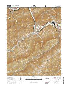
2016 Map of Narrows
USGS Topo · Published 2016About this map
Narrows sits at the dramatic confluence of the New River and Wolf Creek, serving as a central hub in this Virginia-West Virginia borderland. The topography is defined by the steep rises of Peters Mountain and E River Mtn, with the Appalachian National Scenic Trail threading along the high ridges. This modern survey shows the intricate network of family-named cemeteries that dot the landscape, including Fairview Cem, Woolwine Cem, and Hare Cem, offering a detailed spatial record for genealogical research. The Norfolk Southern railroad follows the riverbank, mirroring the transit corridor established by Virginia Ave. Downstream, the Andrew S Rowan Bridge connects Glen Lyn near the state line, while further south, the remote valley of Thessalia and the quiet reach of Wilburn Valley maintain a rural character shielded by the vast acreage of the Jefferson National Forest.
Find a feature on this map
94 named features on this map. Tap any name to fly to it.
Don’t see what you’re looking for? This feature index may not catch every label — zoom into the map to look around manually.
Map Details
Editions of this 2016 Narrows Map
This is the sole edition of this map. No revisions or reprints were ever made.
Other maps of this area

1890 · Dublin
USGS Topo · 1:125,000

1891 · Dublin
USGS Topo · 1:125,000

1913 · Peterstown
USGS Topo · 1:48,000

1916 · Peterstown
USGS Topo · 1:62,500

1923 · Pearisburg
USGS Topo · 1:62,500

1925 · Peterstown
USGS Topo · 1:62,500

1932 · Peterstown
USGS Topo · 1:48,000

1932 · Pearisburg
USGS Topo · 1:48,000

1934 · Pulaski
USGS Topo · 1:48,000

1937 · Pearisburg
USGS Topo · 1:62,500