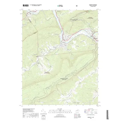
2019 Map of Narrows
USGS Topo · Published 2019About this map
The New River carves a deep path through the Appalachians, anchoring the industrial and transport corridor of Narrows and Glen Lyn. This 2019 survey documents the complex topography of Giles Co and the adjacent Mercer Co and Monroe Co lines, where the Norfolk Southern railroad follows the river's edge. The rugged terrain is defined by the Jefferson National Forest and the Appalachian National Scenic Trail, which winds across high ridges like Fletchers Mountain and through Wilburn Valley. Family history is preserved in numerous upland burial sites, including Hare Cem, Day Cem, and Blankenship Cem. These small settlements and rural crossroads, such as Thessalia and Shumate, illustrate the persistent human footprint within a landscape dominated by steep mountains and narrow creek valleys like Wolf Creek and Sugar Run.
Find a feature on this map
97 named features on this map. Tap any name to fly to it.
Don’t see what you’re looking for? This feature index may not catch every label — zoom into the map to look around manually.
Map Details
Editions of this 2019 Narrows Map
This is the sole edition of this map. No revisions or reprints were ever made.
Other maps of this area

1890 · Dublin
USGS Topo · 1:125,000

1891 · Dublin
USGS Topo · 1:125,000

1913 · Peterstown
USGS Topo · 1:48,000

1916 · Peterstown
USGS Topo · 1:62,500

1923 · Pearisburg
USGS Topo · 1:62,500

1925 · Peterstown
USGS Topo · 1:62,500

1932 · Peterstown
USGS Topo · 1:48,000

1932 · Pearisburg
USGS Topo · 1:48,000

1934 · Pulaski
USGS Topo · 1:48,000

1937 · Pearisburg
USGS Topo · 1:62,500