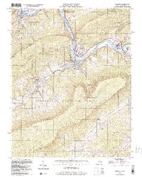
1998 Map of Narrows
USGS Topo · Published 2000About this map
The New River carves a deep path through the mountains of Virginia and West Virginia, meeting the northern reach of Bluestone Lake at a dramatic bend. The town of Narrows serves as a focal point for regional transportation, situated where the Norfolk and Western railway and highway networks converge along the riverbanks. Steep ridges including Peters Mountain and East River Mountain frame the river valley, while the Appalachian Scenic Trail traverses the high ground of the Jefferson National Forest. Family and community history is anchored in local landmarks such as Cedar Grove Ch, Shumate, and numerous burial sites including Woolwine Cem and Day Cem. The map illustrates the 1990s character of the region, where industrial features like the Gaging Station and various quarries operate alongside the natural wonder of Starnes Cavern.
Find a feature on this map
44 named features on this map. Tap any name to fly to it.
Don’t see what you’re looking for? This feature index may not catch every label — zoom into the map to look around manually.
Map Details
Editions of this 1998 Narrows Map
This is the sole edition of this map. No revisions or reprints were ever made.
Other maps of this area

1890 · Dublin
USGS Topo · 1:125,000

1891 · Dublin
USGS Topo · 1:125,000

1913 · Peterstown
USGS Topo · 1:48,000

1916 · Peterstown
USGS Topo · 1:62,500

1923 · Pearisburg
USGS Topo · 1:62,500

1925 · Peterstown
USGS Topo · 1:62,500

1932 · Peterstown
USGS Topo · 1:48,000

1932 · Pearisburg
USGS Topo · 1:48,000

1934 · Pulaski
USGS Topo · 1:48,000

1937 · Pearisburg
USGS Topo · 1:62,500