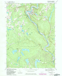
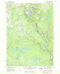
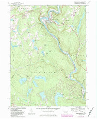
1968 Map of Narrowsburg
USGS Topo · Published 1983About this map
Narrowsburg serves as the focal point for this landscape along the horseshoe bend of the Upper Delaware River. The map captures the interface between New York and Pennsylvania, specifically where Wayne County and Pike County meet Sullivan County. Settlement patterns follow the river and rail corridor, where Conrail tracks pass through Tusten Station and Tusten. The terrain is characterized by numerous glacial bodies of water, including Wolf Lake, Teedyuskung Lake, and Luxton Lake. This 1968 survey, revised in the early 1980s, reflects the transition of the area into a recreational hub, evidenced by Forest Lake Park and Westcolang Park. Local history is anchored by sites like the St Francis Ch and Glen Cove Cem, while industrial traces remain in the form of a Quarry and Gravel Pit near Lava.
Find a feature on this map
62 named features on this map. Tap any name to fly to it.
Don’t see what you’re looking for? This feature index may not catch every label — zoom into the map to look around manually.
Map Details
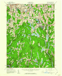
Editions of this 1968 Narrowsburg Map
Other maps of this area

1913 · Milford
USGS Topo · 1:62,500

1915 · Milford
USGS Topo · 1:62,500

1920 · Damascus
USGS Topo · 1:62,500

1922 · White Lake
USGS Topo · 1:62,500

1923 · Damascus
USGS Topo · 1:62,500

1935 · Hawley
USGS Topo · 1:62,500

1938 · Hawley
USGS Topo · 1:62,500

1942 · White Lake
USGS Topo · 1:62,500

1943 · Honesdale
USGS Topo · 1:125,000
1943 · White Lake
USGS Topo · 1:62,500
Featured Places
- Lackawaxen Township, PA
- Damascus Township, PA
- Tusten, NY
- Narrowsburg, Tusten
- Darbytown, Damascus Township