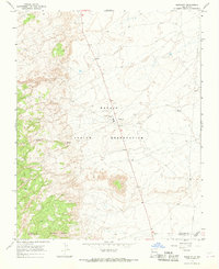
1966 Map of Naschitti
USGS Topo · Published 1969About this map
Navajo Indian Reservation lands dominate this mid-century landscape, centered on the settlement of Naschitti. The map illustrates the practical infrastructure of this high-desert community during the late 1960s, notably the 666 highway (later renumbered) which serves as the primary north-south artery. Water management is a critical theme, visible through the presence of several Well sites and the Sewage Disposal Ponds situated just west of the main settlement. The terrain is defined by the drainage patterns of Naschitti Wash and Salt Springs Wash, which cut through the arid topography near the San Juan Co McKinley Co boundary. This 1966 survey records a moment of mid-century development for the Navajo Nation, capturing local utilities like a WT (water tank) and a significant Pipeline corridor tracing the eastern edge of the quadrangle.
Find a feature on this map
11 named features on this map. Tap any name to fly to it.
Don’t see what you’re looking for? This feature index may not catch every label — zoom into the map to look around manually.
Map Details
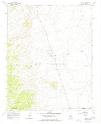
Editions of this 1966 Naschitti Map
2 editions found
Other maps of this area

1886 · Wingate
USGS Topo · 1:250,000

1889 · Chaco
USGS Topo · 1:250,000

1892 · Wingate
USGS Topo · 1:250,000

1892 · Chaco
USGS Topo · 1:250,000

1954 · Shiprock
USGS Topo · 1:250,000

1954 · Gallup
USGS Topo · 1:250,000

1955 · Tohatchi
USGS Topo · 1:62,500

1958 · Gallup
USGS Topo · 1:250,000

1958 · Shiprock
USGS Topo · 1:250,000

1959 · Shiprock
USGS Topo · 1:250,000
Featured Places
- Shiprock Agency
- Fort Defiance Agency
- Naschitti, Fort Defiance Agency
- San Juan County, NM
- McKinley County, NM