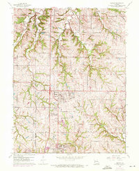
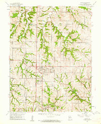
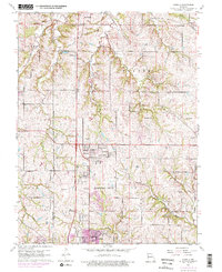
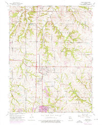
1961 Map of Nashua
USGS Topo · Published 1971About this map
Nashua and Gashland anchor the southern half of this landscape on the northern edge of the Kansas City boundary, where suburban growth began to meet the agricultural hills of Clay and Platte counties. This 1961 survey, with 1970 revisions, documents the era before the large-scale impoundments that would later alter the local hydrology, showing the natural meandering of Shoal Creek and its East Fork as they carve through the local townships of Gallatin and May.
Find a feature on this map
27 named features on this map. Tap any name to fly to it.
Don’t see what you’re looking for? This feature index may not catch every label — zoom into the map to look around manually.
Map Details
Editions of this 1961 Nashua Map
4 editions found
Other maps of this area

1890 · Kansas City
USGS Topo · 1:125,000

1894 · Kansas City
USGS Topo · 1:125,000

1894 · Independence
USGS Topo · 1:125,000

1914 · Smithville
USGS Topo · 1:62,500

1935 · North Kansas City
USGS Topo · 1:24,000

1935 · Liberty
USGS Topo · 1:24,000

1936 · Kearney
USGS Topo · 1:48,000

1940 · Liberty
USGS Topo · 1:31,680

1940 · North Kansas City
USGS Topo · 1:31,680

1942 · Kearney
USGS Topo · 1:62,500