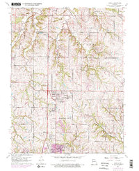
1961 Map of Nashua
USGS Topo · Published 1976About this map
Nashua sits at the center of this Missouri landscape where the expanding Kansas City City Boundary meets the rural townships of Gallatin and Platte. The terrain is defined by the branching waters of Shoal Creek and its tributaries, such as East Fork Shoal Creek, which cut through the ridges north of Gashland. This mid-century record highlights the transition from agricultural land to suburban footprint, noting a Drive-in Theater and the Radio Towers (WCMO) alongside traditional landmarks like Mt Olivet Ch and the Gordon Sch.
Find a feature on this map
28 named features on this map. Tap any name to fly to it.
Don’t see what you’re looking for? This feature index may not catch every label — zoom into the map to look around manually.
Map Details
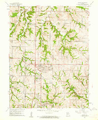
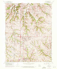
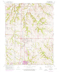
Editions of this 1961 Nashua Map
4 editions found
Other maps of this area

1890 · Kansas City
USGS Topo · 1:125,000

1894 · Kansas City
USGS Topo · 1:125,000

1894 · Independence
USGS Topo · 1:125,000

1914 · Smithville
USGS Topo · 1:62,500

1935 · North Kansas City
USGS Topo · 1:24,000

1935 · Liberty
USGS Topo · 1:24,000

1936 · Kearney
USGS Topo · 1:48,000

1940 · Liberty
USGS Topo · 1:31,680

1940 · North Kansas City
USGS Topo · 1:31,680

1942 · Kearney
USGS Topo · 1:62,500