
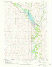
1971 Map of Nashua NW
USGS Topo · Published 1973About this map
Powersville serves as the central point of this rural landscape where the northern reaches of Butler County meet Floyd County. The terrain is defined by a dense network of drainage and local waterways, including the winding paths of Flood Creek, Beaver Creek, and Peters Creek. These streams cut through sections of Pleasant Grove and Riverton, shaping a topography marked by several industrial extractive sites like the various Quarry and Sandpit locations. Genealogists can trace early community focal points at St Johns Ch and the United Ch, alongside historical resting places such as Pleasant Grove Cem and Pleasant Hill Cem. The map's detail extends to fine red dashed lines that indicate selected fence and field lines as they appeared during field checks in the early 1970s.
Find a feature on this map
18 named features on this map. Tap any name to fly to it.
Don’t see what you’re looking for? This feature index may not catch every label — zoom into the map to look around manually.
Map Details
Editions of this 1971 Nashua NW Map
This is the sole edition of this map. No revisions or reprints were ever made.
Other maps of this area

1954 · Mason City
USGS Topo · 1:250,000

1954 · Waterloo
USGS Topo · 1:250,000

1955 · Waterloo
USGS Topo · 1:250,000

1957 · Mason City
USGS Topo · 1:250,000

1958 · Mason City
USGS Topo · 1:250,000

1971 · Plainfield
USGS Topo · 1:24,000

1971 · Charles City
USGS Topo · 1:24,000

1971 · Clarksville
USGS Topo · 1:24,000

1971 · Bassett
USGS Topo · 1:24,000
1971 · Nashua
USGS Topo · 1:24,000