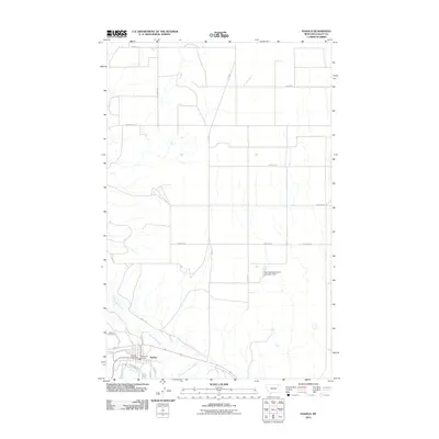
2011 Map of Nashua
USGS Topo · Published 2011About this map
Nashua sits at the confluence of several vital water routes in Valley County, where the meandering Milk River meets the drainages of Porcupine Creek and the Porcupine Creek Overflow. This landscape is defined by the agricultural and transit networks of northeast Montana, with long rural stretches such as Roosevelt Trl and Dead Lamb Rd segmenting the plains north of the township. Local civic life is concentrated near the southern edge of the map, anchored by the Nashua Post Office, the Nashua Vol Fire Dept, and the Nashua Cemetery. The northern portion of the quadrangle is notably sparse, occupied by ranch roads like Cherney Rd and Bauer Rd, while the Fort Peck Reservation Number 6 Dam stands as a significant infrastructure feature within the tribal lands to the east.
Find a feature on this map
24 named features on this map. Tap any name to fly to it.
Don’t see what you’re looking for? This feature index may not catch every label — zoom into the map to look around manually.
Map Details
Editions of this 2011 Nashua Map
This is the sole edition of this map. No revisions or reprints were ever made.
Other maps of this area

1914 · Nashua
USGS Topo · 1:62,500

1915 · Frazer
USGS Topo · 1:62,500

1915 · Spring Creek
USGS Topo · 1:62,500

1916 · Nashua
USGS Topo · 1:62,500

1918 · Porcupine Valley
USGS Topo · 1:62,500

1954 · Glasgow
USGS Topo · 1:250,000

1957 · Glasgow
USGS Topo · 1:250,000

1958 · Glasgow
USGS Topo · 1:250,000
1972 · Milk River Coulee
USGS Topo · 1:24,000
1972 · Milk River Hills
USGS Topo · 1:24,000