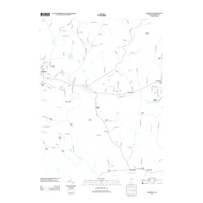
2013 Map of Nashville
USGS Topo · Published 2013About this map
Nashville and the surrounding Brown County landscape exhibit a pattern of development closely tied to the complex ridge-and-hollow topography. In the early 21st century, the area remains defined by significant high points such as Weed Patch Hill, Limekiln Ridge, and Hohen Point, which separate the various drainages of the North Fork Salt Cr. Small settlements and distinct family-named hollows like Weddle Hollow and Pittman Hollow are scattered along the winding road network, including the path of Old State Hwy 46. The prevalence of small lakes, such as Greenbriar Lake and Ogle Lake, alongside landmarks like the Lilly Lookout Tower and Hesitation Point, reflects a region shaped by both its agricultural roots and its role as a destination for outdoor observation.
Find a feature on this map
72 named features on this map. Tap any name to fly to it.
Don’t see what you’re looking for? This feature index may not catch every label — zoom into the map to look around manually.
Map Details
Editions of this 2013 Nashville Map
This is the sole edition of this map. No revisions or reprints were ever made.
Other maps of this area

1942 · Franklin
USGS Topo · 1:125,000

1946 · Belmont
USGS Topo · 1:24,000

1947 · Nashville
USGS Topo · 1:24,000

1947 · Elkinsville
USGS Topo · 1:24,000

1947 · Franklin
USGS Topo · 1:62,500

1948 · New Bellsville
USGS Topo · 1:24,000

1948 · Waymansville
USGS Topo · 1:24,000

1948 · Nineveh
USGS Topo · 1:24,000

1948 · Fruitdale
USGS Topo · 1:24,000

1948 · Morgantown
USGS Topo · 1:24,000