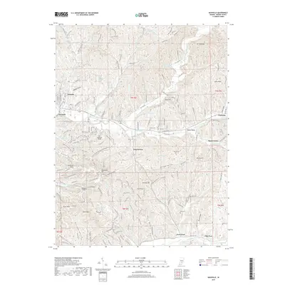
2019 Map of Nashville
USGS Topo · Published 2019About this map
Nashville serves as the focal point of this Brown County landscape, where the street grid of Jefferson St N and N Van Buren St transitions into a complex network of ridges and hollows. The area is characterized by a high density of small lakes and reservoirs, including Lake of the Clouds, Ogle Lake, and Strahl Lake, which are interspersed among named elevations like Weed Patch Hill and Hesitation Point. To the east and south, smaller named locales such as Gnaw Bone and Stone Head mark rural crossroads, while the terrain is deeply etched by Pittman Hollow and Weddle Hollow.
Find a feature on this map
164 named features on this map. Tap any name to fly to it.
Don’t see what you’re looking for? This feature index may not catch every label — zoom into the map to look around manually.
Map Details
Editions of this 2019 Nashville Map
This is the sole edition of this map. No revisions or reprints were ever made.
Other maps of this area

1942 · Franklin
USGS Topo · 1:125,000

1946 · Belmont
USGS Topo · 1:24,000

1947 · Nashville
USGS Topo · 1:24,000

1947 · Elkinsville
USGS Topo · 1:24,000

1947 · Franklin
USGS Topo · 1:62,500

1948 · New Bellsville
USGS Topo · 1:24,000

1948 · Waymansville
USGS Topo · 1:24,000

1948 · Nineveh
USGS Topo · 1:24,000

1948 · Fruitdale
USGS Topo · 1:24,000

1948 · Morgantown
USGS Topo · 1:24,000